COGO Rotate
- The points below represent shots downloaded from a data collector - The
total station was not aligned in the field
- The two wide black lines represent the edges of a road
- The road has a North South alignment - thus we need to Rotate to correct
the direction


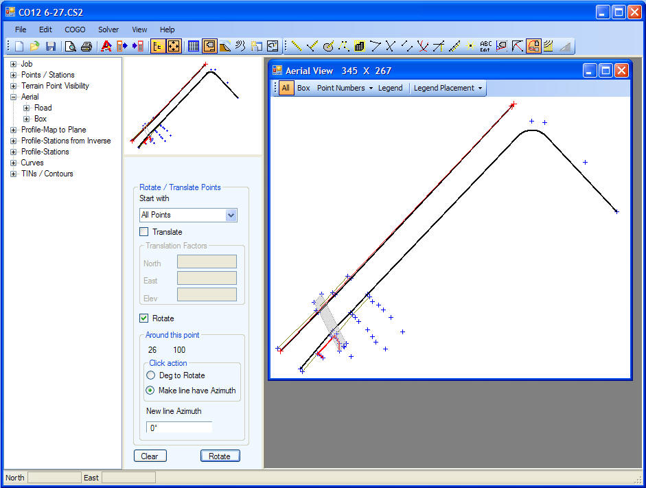
- Rotate
selected
- To correct the alignment the points are Rotated
- Select a point to rotate about
- A line is defined from the Rotate point to an Edge of Road point of
which the Azimuth should be 0 degrees
- Rotate was clicked
- Below is the result of the rotation
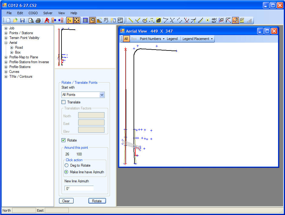
back